Purpose-built for the water
Every feature designed for boaters, anglers, and water enthusiasts. Not repurposed from land apps.
Features shown represent our planned capabilities at launch. All data is for informational purposes only.
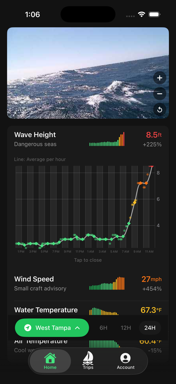
Live Conditions & BuoyCAM
Live wave height, wind speed, water temperature, air pressure, and BuoyCAM camera feeds from NOAA stations — all in one view. Color-coded safety ratings from Excellent to Dangerous give you an instant read on conditions, while auto-refreshing camera streams put eyes on the water before you leave the dock.
Tap any metric to expand into a detailed chart with hourly bucketing, aggregation lines, and raw data points. Drill into the data the way you want to see it.
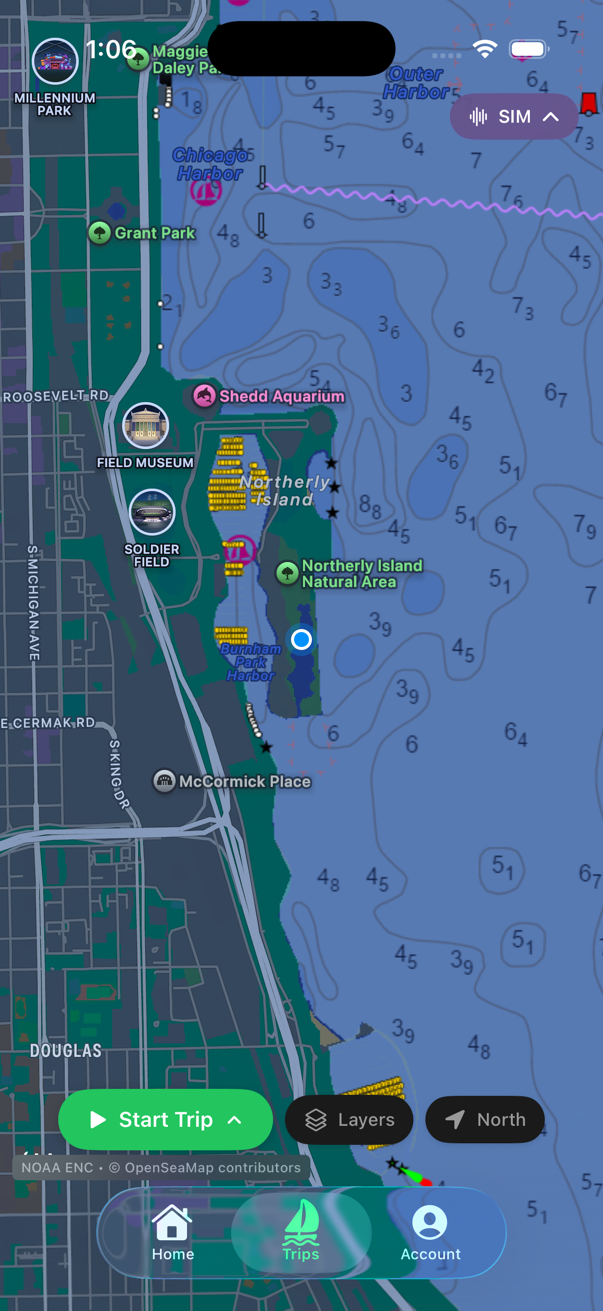
Nautical Chart Overlay
NOAA depth contours and OpenSeaMap navigation aids overlaid on Apple Maps. See depth soundings, channel markers, buoys, and other aids to navigation right on your map.
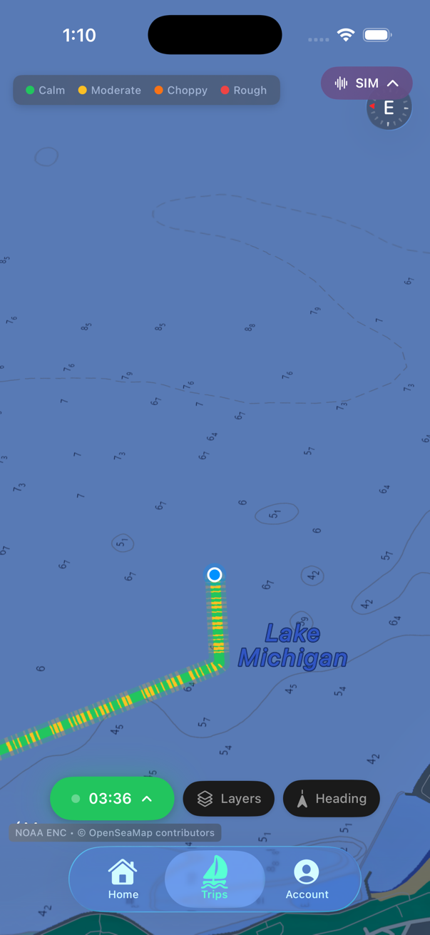
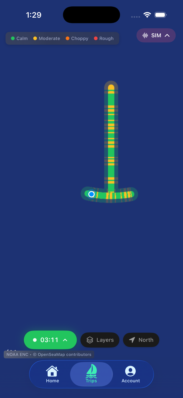
Not Your Typical Trip Monitor
We combine trip recording with real-time roughness sensing to build a live community of on-the-water conditions. Your device's accelerometer maps motion to the Douglas Sea Scale while GPS tracks your route, distance, and speed — so every trip contributes to a shared picture of what it's actually like out there.
Boaters helping boaters. The more trips recorded, the richer the conditions data becomes for everyone on the water.
Anchor Alarm System
More than a simple geofence — Good Buoy tracks anchor drag visually and with community awareness. The system monitors drag distance, swing counts, and other metrics as a supplemental monitoring tool while anchored.
Get notified if your anchor position changes. The anchor alarm is a supplemental tool only — always maintain proper anchor watches.

Station Discovery & Favorites
Browse 122 curated buoy stations by region, proximity, or search. Add favorites that sync across all your devices via your account. Each station shows its current safety rating and last report time.
Ready to feel the water?
Coming soon to the App Store.